Heavy Rain falls In Areas Of Saurashtra-Kutch Region
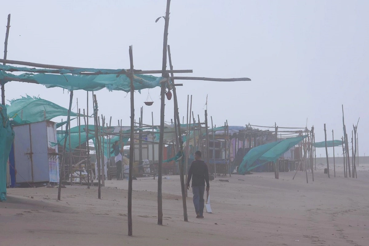
Parts of the Saurashtra Kutch region experienced heavy rainfall and strong winds as cyclone Biparjoy approached the Gujarat coast on Wednesday, according to the Met Department.
54 talukas in the districts of Saurashtra and Kutch received more than 10 mm of rain in the 24 hours that ended on Wednesday morning, according to a release from the State Emergency Operation Center (SEOC).
In the districts of Devbhumi Dwarka, Rajkot, Jamnagar, Porbandar, and Junagadh, the rainfall was heavier.
According to the Met Department, heavy rain and strong winds were observed in several areas of the Saurashtra-Kutch region on Wednesday as cyclone Biparjoy approached the Gujarat coast.
According to a statement from the State Emergency Operation Center, 54 talukas in the districts of Saurashtra and Kutch got more than 10 mm of rain in the 24 hours that ended on Wednesday morning (SEOC).
Rainfall was heavier in the Devbhumi Dwarka, Rajkot, Jamnagar, Porbandar, and Junagadh districts.
This would likely cause some areas in Porbandar, Rajkot, Morbi, Junagadh, and other districts in Saurashtra and North Gujarat to experience heavy to extremely heavy rains on Thursday.
On Friday, the IMD has also predicted light to moderate rain, with isolated areas of heavy to extremely heavy rain over districts in north Gujarat and nearby south Rajasthan.
Wind speeds will reach 65-75 kmph gusting to 85 kmph along and off the coasts of the districts of Porbandar and Devbhoomi Dwarka from Wednesday forenoon, the IMD said.
On Thursday, they will gradually pick up speed along and offshore the districts of Kutch, Devbhumi Dwarka, Porbandar, Jamnagar, Rajkot, Junagarh, and Morbi, gusting to 150 kmph.
Sea condition is likely to be very rough till the evening of Wednesday along Saurashtra and Kutch coasts and high to phenomenal till the evening of Thursday before becoming normal, the IMD said.
Low-lying parts of the affected regions are anticipated to be inundated during the time of impact by a storm surge of roughly 2-3 m above the astronomical tide. The Met agency stated that the tides might range from 3-6 metres in several locations.
Also read: NEET UG Topper Inspired From Appreciation Bagged By Doctors During Covid-19 Pandemic, Scores AIR 7


To read more such news, download Bharat Express news apps