Avalanche Warning In J&K
Jammu and Kashmir authorities have issue an avalanche warning in 10 district in the next 24 hours. According to the J&K State Disaster Management (JKSDM), a High danger level avalanche warning above 200 metres has been issued for Bandipora and Kupwara districts for the next 24 hours.
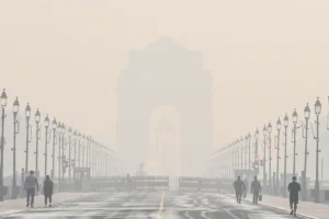
The northern states might experience a comeback of the bone chilling cold weather. Moreover, the AQI of the national capital remained in ‘very poor’ category.
Warning Issued In J&K
A low-danger level avalanche is likely to occur above 2,000 metres over Anantnag, Doda, Kishtwar, Kulgam, Poonch and Ramban districts in the next 24 hours. People living in these areas are advised to take precautions and avoid venturing into avalanche-prone areas, said the release.
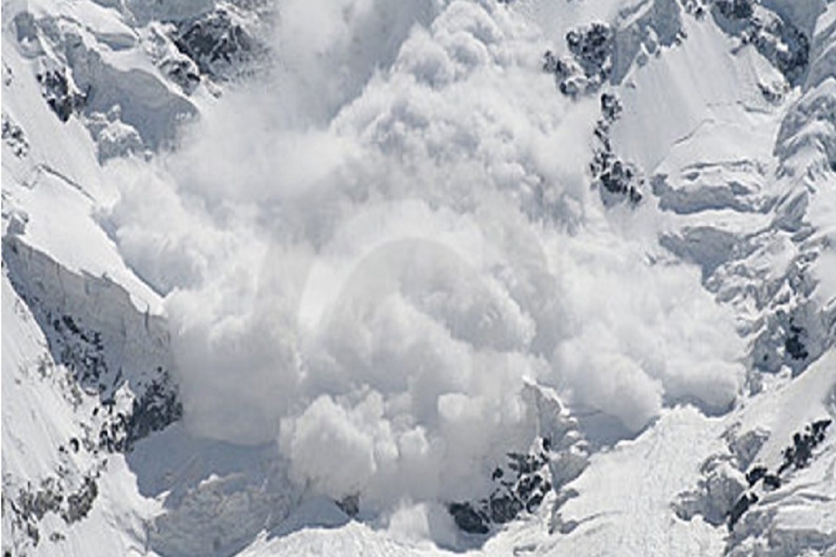
On Thursday (January 12), an avalanche struck Baltal along the Zojila pass in the Sonamarg area of Jammu and Kashmir.
#WATCH | Jammu and Kashmir: A snow avalanche occurred near Baltal, Zojila in Sonamarg area of Ganderbal district. No loss has been reported. pic.twitter.com/BdGLhOEOhz
— ANI (@ANI) January 12, 2023
The air traffic of Kashmir was suspended on Friday and flights for the rest of the day cancelled due to snowfall across the valley, officials said. Flight operations had taken place in the morning, but had to be suspended due to continuous snowfall and low visibility, the officials said.
“All flights for today at our airport have been cancelled due to continuous bad weather,” the officials at the Srinagar airport said.
They said the passengers of the cancelled flights would be accommodated by the respective airlines in the next available flight “at no extra cost”. The fresh snowfall, including in Srinagar and other plains, started early Friday and continued till last reports came in.
A Comeback Of Cold Wave In Northern States
According to the Meteorological Department, by January 16 the minimum temperature in many parts of northwestern India can reach 3-5 degrees Celsius. The temperature in Madhya Pradesh is likely to drop by 3-5 degree Celsius during the next 24 hours. After this there will be no significant change.
The minimum temperature is likely to drop by 2-3 degree Celsius over the state of Gujarat during next 3 days and there will be no significant change thereafter. There will be no significant change in the minimum temperature over the rest of the country during the next 5 days.
In a report by the IMD, “Due to continuation of prevailing light winds and high moisture near surface over Indo-Gangetic plains, dense to very dense fog very likely to continue in isolated/some parts during night & morning hours over Bihar during 13th-17th.”
Delhi’s AQI: Very Poor
The air quality in the national capital continued in the ‘very poor’ category on Saturday. The overall Air Quality Index on Wednesday morning was recorded at 337, marking a slight improvement from Friday according to the SAFAR monitoring system. On Friday evening, the AQI was recorded at 378 in the severe category.
The pollution level in Noida was slightly worse than in Delhi. The AQI stood at 346 in Noida in the severe category. In Gurugram, the index recorded 327, also in the very poor category.
All monitoring stations in the city also registered a fall in air quality and continued in the severe category.
In Pusa, the AQI was 329 while Delhi University recorded it at 357. The index in the Airport region touched 326 and for Mathura Road, it was 349. Ayanagar also was in the very poor category in 2326. Lodhi Road and IIT Delhi remained in the ‘very poor’ category with AQI 327 and 337 respectively at 6:30 am on Saturday.
To read more such news, download Bharat Express news apps