



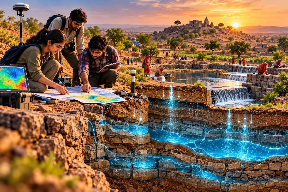
AI Generated Image
Reviving Saraswati: How Young Hydro-Geologists Restored Underground Aquifers Across Bundelkhand
Bundelkhand’s water story is often told through drought, cracked fields and migration. But beneath that difficult surface lies another story: young hydro-geologists reading the land, mapping hidden aquifers and helping communities restore groundwater systems through patient, science-led interventions. This article explains how their approach works, why underground aquifers matter and what other water-stressed regions can learn from these efforts.
What Does It Mean to Revive an Underground Aquifer?
Reviving an underground aquifer means helping the ground store, retain and gradually release water again. It is not the same as simply digging a deeper borewell or finding a new water source. Instead, it focuses on understanding how rainwater enters the soil, how it moves through rock and sediment, where it gets blocked or lost, and how recharge can be improved without damaging the local ecology.
In a region like Bundelkhand, this work becomes especially important because water stress is not caused by low rainfall alone. It is also influenced by how quickly rain runs off hard surfaces, how much soil has eroded, which traditional water bodies have been neglected and how groundwater extraction has changed over time. Young hydro-geologists bring a scientific perspective to these questions, but their success depends just as much on local knowledge, village participation and long-term maintenance.
The word ‘Saraswati’ in this context works as a powerful metaphor. It suggests a hidden river, an unseen flow beneath the land, waiting to be understood rather than forced. The task is not to manufacture water, but to restore the conditions that allow it to return, remain and serve people, crops, trees and livestock through the dry months.
Bundelkhand’s Water Challenge Runs Deeper Than Rainfall
Bundelkhand stretches across parts of Uttar Pradesh and Madhya Pradesh, and its landscape is known for rocky terrain, seasonal rivers, uneven rainfall and a long history of agrarian hardship. When rain arrives, it can be intense, but the land does not always benefit fully. Water may rush away through gullies and drainage lines before it has enough time to soak into the ground.
That creates a frustrating cycle. Villages may experience flooding or heavy runoff during the monsoon, then face acute scarcity just a few months later. Wells that once held water for longer may dry up earlier. Farmers may invest in deeper borewells, only to discover that depth alone does not solve a recharge problem. The result is both emotional and economic stress, especially for households dependent on rain-fed farming.
Hydro-geologists look at this cycle differently from those who focus solely on increasing extraction. They ask where water can be slowed, where it can spread, where it can percolate and which underground formations are capable of storing it. That shift changes the conversation from emergency supply to landscape recovery.
The phrase hydro-geologists Bundelkhand is more than a search keyword; it points to a practical need for trained professionals who can interpret the region’s geology, hydrology and community water patterns together. Without that combined understanding, well-intentioned projects may place recharge structures in unsuitable locations or treat every village as though its underground water system behaves in the same way.
The Young Hydro-Geologist’s Role Is Part Science, Part Fieldwork, Part Trust-Building
Hydrogeology is the study of groundwater: where it is found, how it moves, how it is replenished and how it can be used responsibly. In the field, that means a hydro-geologist is not simply someone with maps and instruments. They are also a listener, observer, translator and problem-solver.
Young professionals entering Bundelkhand’s villages often begin with basic but essential questions. Which wells dry up first? Which remain productive for the longest? Where does water accumulate after rain? Which fields suffer from erosion? Which old ponds, tanks or streams have changed over the years? These questions help connect community memory with scientific observation.
Once that initial understanding is established, the technical work becomes more precise. Rock type, fractures, slopes, drainage lines, soil depth and land use all influence recharge potential. A recharge trench in one location may help, while the same structure elsewhere may fail because the subsurface conditions differ. Hydrogeology reduces guesswork.
Trust-building matters because groundwater is shared, even when wells are privately owned. If one farmer extracts heavily, nearby wells can be affected. If a recharge structure is neglected upstream, households downstream may lose out. Young hydro-geologists therefore need to communicate clearly, avoid unnecessary jargon and show communities why a collective approach is more reliable than individual extraction.
How Did Young Hydro-Geologists Help Restore Aquifers Across Bundelkhand?
Young hydro-geologists helped by combining village-level knowledge of water with scientific mapping, then guiding practical recharge interventions in places where the land could absorb and store water. Their work typically involved studying wells, slopes, rock formations, drainage paths and seasonal water behaviour before recommending measures such as restoring ponds, slowing runoff, improving percolation, protecting catchments and encouraging more responsible groundwater use.
The strength of this approach is that it treats aquifer restoration as a system rather than a single structure. A check dam, farm pond, contour trench or restored tank can be useful, but only when it suits the local hydrogeological setting. If water is blocked where the rock cannot absorb it, the benefit may be limited. If recharge is encouraged near a suitable fracture zone or natural drainage path, the same investment can deliver better results.
Young hydro-geologists also helped shift expectations. Communities understandably want immediate access to water. But aquifer revival may require repeated monsoons, maintenance and careful monitoring. The work is less dramatic than drilling a new borewell, yet it can be more sustainable because it rebuilds the underground reserve instead of merely pursuing what remains.
A Practical Restoration Sequence
Although every village landscape is different, aquifer revival often follows a sequence like this:
- Listening to Local Water History: Villagers identify old wells, seasonal streams, ponds, dry hand pumps, flood paths and areas where water once lasted longer. This helps reveal patterns that maps alone may miss.
- Mapping the Land and Subsurface: Hydro-geologists study slopes, drainage, soil depth, rock type, fractures and existing water points. The goal is to identify recharge opportunities and understand how groundwater may move.
- Choosing Recharge Zones Carefully: Instead of placing structures wherever land is available, the team prioritises areas where water can slow down and enter the aquifer effectively.
- Restoring or Building Suitable Structures: Work may include desilting ponds, repairing traditional tanks, creating contour bunds, improving field channels, treating gullies or constructing small structures to slow runoff.
- Monitoring Wells and Seasonal Changes: Water levels, well performance and community observations are tracked over time. Monitoring helps establish whether interventions are working and where adjustments are needed.
- Building Maintenance Habits: Recharge systems fail when silt accumulates, embankments break or catchments are encroached upon. Community-led maintenance keeps the work going after the initial project ends.
This sequence is straightforward to describe but demanding to execute. It requires patience, field discipline and respect for both science and community knowledge.
Reading the Land Before Touching the Water
One of the most important lessons from aquifer restoration is that the visible landscape provides clues about the invisible one. A rocky outcrop, a line of trees, a moist patch after rainfall, a bend in a seasonal stream or the location of an old well can all indicate how water behaves below the surface. Young hydro-geologists are trained to notice these details and connect them into a working picture.
In Bundelkhand, hard-rock geology can make groundwater especially complex. Unlike large alluvial aquifers, where water may be stored across broad sediment layers, hard-rock areas often depend on fractures, joints, weathered zones and local storage pockets. This means groundwater availability can vary sharply over short distances. Two wells in the same village may behave differently because underground pathways are not uniform.
This is why local mapping is so valuable. A broad regional map can provide context, but village-level decisions require closer observation. Where does the slope direct runoff? Where has soil accumulated? Which rock zones are weathered enough to accept recharge? Where might a structure cause waterlogging instead of useful percolation? These details help prevent expensive mistakes.
The most effective hydro-geologists do not enter the field with a fixed design. They let the land narrow the options, then match interventions to the setting.
Community Knowledge Turns Technical Plans Into Living Systems
Aquifer restoration cannot succeed as a purely technical exercise. The people who live with the land every day know when a well changed, which pond filled first, where cattle drink, which field channels overflow and how water disputes arise. Their knowledge may not use scientific vocabulary, but it often captures decades of observation.
Young hydro-geologists who respect this knowledge can design better interventions. For example, an elderly farmer may remember that a neglected pond once held water into summer. Women who collect water may know which hand pumps fail first. Shepherds may recognise seasonal wet patches across common land. These observations help refine recharge planning.
Community participation also protects the work after construction. If a pond is restored but its catchment is blocked, silted up or used as a dumping site, its recharge value declines. If field bunds are cut during cultivation, runoff patterns change again. Similarly, if no one monitors water levels, early warning signs are missed. Local ownership turns a project into an ongoing practice.
What Communities Contribute Beyond Labour
Community participation is often described in terms of physical work, but its deeper value includes:
- Historical Memory: People remember old water bodies, abandoned wells and changes in cropping or extraction patterns.
- Daily Observation: Residents notice small changes in water levels, soil moisture and seasonal flows before outsiders do.
- Maintenance Capacity: Local groups can desilt, repair, protect and monitor structures long after experts leave.
- Social Coordination: Groundwater recharge benefits many people, so village-level agreements help reduce conflict.
- Practical Prioritisation: Communities can identify which water points most urgently support drinking water, livestock, kitchen gardens and farming.
When hydro-geologists and communities work together, restoration becomes more grounded. Science helps establish what is possible; local participation makes the work durable.
Restoring Aquifers Means Working With the Monsoon, Not Waiting for It
A common mistake in drought-prone areas is to assume that water management begins when the rains fail. In reality, aquifer restoration must be planned before the monsoon, tested during the monsoon and maintained afterwards. The rainy season is not just a weather event; it is the main recharge opportunity of the year.
Preparation may include clearing inlet channels, removing silt from ponds, repairing bunds, marking overflow routes and ensuring that recharge structures are not blocked by debris. When rain arrives, water should be able to slow down, spread and soak into the ground rather than cut new erosion channels. Even small design errors can become apparent during heavy rainfall.
After the monsoon, monitoring becomes important. Did restored ponds hold water for longer? Did nearby wells show improvement? Similarly, did some structures accumulate silt too quickly? Did runoff bypass the intended recharge zone? These observations help improve the next cycle.
This seasonal rhythm is one reason young hydro-geologists can be especially effective when they remain involved beyond a single intervention. Aquifer revival is iterative. Every season teaches something about the land.
The Difference Between Extraction and Recharge Thinking
Groundwater conversations often begin with scarcity: the well is dry, the pump has failed, or the borewell must go deeper. This is extraction thinking. It treats groundwater mainly as a resource to be accessed.
Recharge thinking asks a different set of questions. Why is the aquifer not being replenished adequately? Where is rainwater being lost? What has changed in the catchment? Which traditional systems have broken down? How can water demand be managed alongside supply? This approach may take longer, but it is also more resilient.
The distinction matters because deeper extraction can create a false sense of security. A new borewell may provide relief, but if recharge remains poor, pressure on the aquifer continues. In hard-rock regions, over-extraction can be especially risky because storage is often limited and unevenly distributed.
Aquifer restoration does not reject wells, pumps or modern water systems. It insists that access must be balanced with replenishment. A well is more sustainable when the surrounding landscape is healthy, too.
Field Tools Help, but Judgement Matters More
Modern hydrogeology can draw on many tools: GPS mapping, satellite imagery, geological surveys, water-level measurements, well inventories, rainfall records and, in some cases, geophysical methods. These tools can make groundwater assessments more accurate, especially when combined with field verification. But tools do not replace judgement.
A satellite image may show drainage lines, vegetation patterns or surface water bodies. A field visit reveals whether those channels are blocked, eroded, encroached upon or seasonally active. A map may suggest a promising recharge zone. Local residents may explain that the area floods dangerously or is affected by social conflict. Good hydrogeology integrates all this information.
For young professionals, this is where field learning becomes invaluable. Textbook knowledge provides the foundation, but landscapes teach nuance. Each village becomes a case study in how geology, climate, land use and human behaviour interact.
A Useful Field Checklist for Aquifer Restoration
Before recommending a recharge intervention, a hydro-geologist may need to understand:
- Surface Flow: Where does rainwater move during heavy showers?
- Slope: Is water moving too quickly to infiltrate?
- Soil Depth: Is there enough soil cover to support percolation and vegetation?
- Rock Condition: Are there weathered or fractured zones that can store water?
- Existing Water Bodies: Can ponds, tanks or wells be restored before new structures are built?
- Silt Load: Will the structure quickly fill with sediment if upstream erosion is not addressed?
- Water Demand: How much pressure is placed on the aquifer by irrigation, domestic use and livestock?
- Maintenance Ownership: Who will clean, repair and monitor the system?
- Equity: Will benefits reach only a few landholders, or support the wider village?
This checklist keeps restoration grounded. It also reminds everyone that aquifer revival is as much about governance as engineering.
Why Young Professionals Are Changing the Water Conversation
Young hydro-geologists bring energy, technical training and often a willingness to work across disciplines. Many are comfortable using digital tools, but they are also learning that groundwater restoration requires humility. The aquifer cannot be seen directly. Its characteristics must be inferred from evidence, monitored over time and managed collectively.
Their role is valuable because water-stressed regions need more than construction targets. They need people who can assess whether a structure belongs in a particular place, whether it is likely to recharge the right zone and whether it fits the community’s long-term needs. In other words, they help move projects from activity-based work to outcome-based thinking.
Young professionals can also act as translators between institutions and villages. Government departments, non-profits, academic teams and local communities often use different planning language. A hydro-geologist who can explain why a recharge site matters, what maintenance is required and how success should be measured can reduce confusion and build confidence.
The search for hydro-geologists Bundelkhand also reflects a broader shift: water security is becoming a defining challenge for a new generation of earth scientists, engineers, planners and community workers. Their work may not always be visible, but its impact can be felt when wells last longer, farmers take fewer desperate risks and villages begin to trust the land again.
Aquifer Revival Supports Farming, Drinking Water and Dignity
The benefits of groundwater restoration are not only technical. Water shapes daily life. It affects what farmers plant, whether families migrate for work, how far women and children travel for water, how livestock survive the summer and whether village institutions can plan with confidence.
When aquifers recover, even modest improvements can matter. A well that lasts longer into the dry season can support a kitchen garden. A revived pond can serve livestock and recharge nearby groundwater. Improved soil moisture can reduce crop stress. More reliable drinking water can ease daily anxiety.
It is important not to overpromise. Aquifer restoration cannot eliminate every climate risk, guarantee every crop or replace the need for careful water use. But it can strengthen local resilience, give communities more options and reduce dependence on emergency measures.
The dignity aspect is easy to overlook. Scarcity often forces people into difficult choices: leaving home for work, borrowing money for deeper drilling, abandoning fields or queuing for water. Restoring groundwater systems helps rebuild a sense of agency. People are not merely waiting for relief; they are participating in recovery.
Traditional Water Wisdom Still Has a Place
Bundelkhand, like many semi-arid regions, has a history of local water systems shaped by experience. Ponds, tanks, step-like collection points, earthen bunds, field channels and community-managed catchments were not random features. They reflected generations of observation about where water gathered and how it could be retained.
Modern hydrogeology does not have to replace this wisdom. At its best, it helps evaluate, repair and adapt it. A traditional pond may need desilting, catchment protection, inlet correction or downstream recharge planning. A field bund may need better alignment. A drainage line may need erosion treatment before a water-harvesting structure can work effectively.
This blend of old and new is especially useful because traditional systems often had social rules attached to them. Who cleaned the pond? When could water be used? Which areas had to remain open for water flow? As those rules weaken, the structures deteriorate. Reviving aquifers may therefore require restoring local responsibility as much as physical infrastructure.
The most promising restoration work does not romanticise the past. It asks what still works, what needs redesign and what science can add.
The Invisible Nature of Groundwater Makes Communication Essential
Surface water is easy to see. A full pond, flowing stream or dry tank communicates its condition instantly. Groundwater is different. Because it is hidden, people may not realise how stressed an aquifer is until wells begin failing.
This invisibility makes public communication a central part of hydrogeology. Villagers need simple ways to understand recharge zones, extraction pressure, seasonal fluctuations and shared risks. A chart showing well levels over time can be more persuasive than a long technical lecture. A village map marking runoff paths and recharge sites can help people see their landscape as one connected system.
Young hydro-geologists often become storytellers of the underground. They explain that a well is not an isolated hole, that water does not obey property boundaries and that recharge in one location may benefit another. When people understand this, they are more likely to protect catchments, maintain structures and discuss water use collectively.
Simple Ways to Make Groundwater Visible
Communities and field teams can improve understanding through practical tools:
- Well Diaries: Record water depth before and after the monsoon, then compare results year by year.
- Village Water Maps: Mark wells, ponds, drainage lines, recharge structures and dry zones.
- Seasonal Calendars: Track when water sources fill, decline and fail.
- Photo Monitoring: Take repeat photographs of ponds, gullies and channels from the same location.
- Public Display Boards: Share maintenance dates, water-level trends and community responsibilities.
These tools do not need to be complicated. Their value lies in consistency. When data becomes visible, the aquifer becomes part of public decision-making.
What Can Other Drought-Prone Regions Learn From Bundelkhand?
Other drought-prone regions can learn that groundwater restoration works best when it begins with local hydrogeology, respects community knowledge and treats recharge as a long-term system rather than a one-time construction project. The Bundelkhand approach highlights the importance of placing the right intervention in the right landscape, maintaining it over time and measuring success through water behaviour rather than simply counting completed structures.
The first lesson is to avoid copy-and-paste solutions. A recharge structure that works in one village may fail in another if the slope, soil, rock or drainage pattern differs. Local diagnosis saves money and improves outcomes.
The second lesson is that community ownership cannot be added at the end. People should be involved from the mapping stage because they know the land’s history and will be responsible for upkeep. Participation is not a formality; it is part of the technology.
The third lesson is that demand management must accompany recharge. If groundwater extraction continues to increase without restraint, recharge gains may quickly be consumed. Water budgeting, crop choices, irrigation practices and shared norms all influence whether aquifer recovery lasts.
Finally, regions facing climate variability need flexible systems. Restoration should be monitored and adjusted. A failed structure is not only a failure; it is information. A successful recharge zone can help identify where to focus next.
Responsible Groundwater Use Is Part of Restoration
Aquifer revival can be undermined if water use expands as soon as availability improves. This is a common risk: when wells recover, extraction may increase, returning the aquifer to stress. Sustainable restoration therefore requires both supply-side and demand-side thinking.
On the supply side, communities improve recharge by slowing runoff, restoring water bodies, treating catchments and protecting infiltration zones. On the demand side, they consider how water is used, which crops are grown, how irrigation is applied and whether pumping practices are fair. Neither side is sufficient on its own.
This does not mean farmers should be blamed for using water. Farmers respond to risk, markets, debt and survival needs. But any serious water plan must acknowledge that groundwater is finite. If recharge is everyone’s responsibility, extraction must also be discussed collectively.
Hydro-geologists can support this conversation with evidence. When water-level trends are tracked, communities can see whether the aquifer is improving, remaining stable or declining. Data makes difficult discussions more transparent.
A Quieter Model of Climate Resilience
Climate resilience is often discussed through large infrastructure, new technologies or emergency responses. Aquifer restoration is quieter. It happens through field visits, village meetings, maps, trenches, ponds, repaired bunds, monitored wells and repeated seasonal learning.
That quietness can make it easy to undervalue. A restored aquifer does not announce itself like a dam or pipeline. Its success may appear through the absence of problems: fewer dry wells, fewer tanker trips, less panic before summer and fewer abandoned fields. These are powerful outcomes, even when they are not dramatic.
For Bundelkhand, the revival of underground aquifers represents a different relationship with water. Instead of treating each drought as an isolated disaster, this approach asks how the landscape can be prepared to receive rain more effectively. Instead of chasing water deeper underground, it encourages water to return to the ground.
This is why the role of young hydro-geologists matters. They are not simply technicians; they are part of a generational shift towards science-based, community-rooted water stewardship.
The Road Ahead for Bundelkhand’s Hidden Water
The work of aquifer restoration is never finished after one good season. Climate uncertainty, land-use change, growing water demand and maintenance challenges all require continued attention. The work underway in parts of Bundelkhand needs to be strengthened through training, local institutions, transparent monitoring and careful planning.
More young people can be encouraged to enter hydrogeology, watershed management, soil conservation and community water governance. Schools, local groups and village institutions can also help make groundwater literacy more common. When people understand the basics of recharge and extraction, they are better equipped to protect their future.
The most important step is to keep the work grounded. Every intervention should answer practical questions: Where will the water come from? Where will it go? Who will maintain the system? How will success be measured? Who benefits, and who might be left out?
Bundelkhand’s hidden aquifers will not be revived by slogans. They will be revived through disciplined observation, patient restoration and communities that see water not as a private race to the deepest point, but as a shared reserve beneath their feet.
A Grounded Takeaway
The story of young hydro-geologists in Bundelkhand is hopeful because it is practical. It does not depend on miracle rainfall or one grand solution. It depends on reading the land carefully, placing recharge interventions where they belong, respecting local knowledge and maintaining systems season after season.
Reviving ‘Saraswati’ is ultimately about making the invisible visible. When underground water is understood, measured, protected and replenished, villages gain more than water security. They gain the confidence to plan, farm and live with greater resilience in a changing climate.
Also Read: Quantum Leap Robotics: First-Gen Learners From Tier-3 India Drive Future Innovation
To read more such news, download Bharat Express news apps